The Southwest Transportation Workforce Center (SWTWC) has teamed up with Los Angeles Trade Technical College (LATTC) to create and offer a pilot transportation planning curriculum to demonstrate how students can use Geographic Information Systems (GIS) as an entry to transportation planning career pathways where none formally existed. This pilot is being funded through a grant to the SWTWC-led NNTW in partnership with LATTC and Trade Tech’s Transportation Workforce Institute (TWI). The program is called ARC 341: GIS Metropolitan Access Planning Systems, is offered as part of a for-credit LATTC course.
“This course is designed to empower underrepresented and disadvantaged populations by demonstrating the viability of career pathways between two and four-year institutions in the area of transportation planning,” said SWTWC Director Thomas O’Brien. “While most 4-year planning programs teach GIS to transportation students, we want to teach transportation to GIS students as a way to raise awareness of GIS application and its relevance in transportation related careers.”
The LATTC pilot course also extends opportunities to K-12 students through the college’s dual enrollment program. “By linking this course to both K-12 and college students, we are able to create a complete career pathway for students across the academic continuum,” O’Brien added.
“Students interested in learning about GIS can gain a valuable skillset from this course and apply it to their future career, whether it be in urban planning, transportation planning, or any other related field,” said TWI Director Jess Guerra.

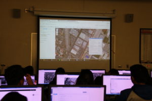
GIS Pilot Course Classroom Activity
Geographic Information Systems manage and analyze spatial data and are valuable tools in addressing various real-world problems that have a spatial component. This course introduces students to fundamental principles and concepts that reinforce the practice of geographic analysis with GIS, including: computer representation of geographic data, vector and raster data models, map projections, coordinate systems, spatial analysis, and map design. After completing this course, students will be able to apply their knowledge and skills to perform real-world tasks and solve problems.
The spring 2018 course started on February 24, 2018 and will run through the end of May. Students who complete the course will earn transferable credits to UC and CSU schools.
LATTC’s mission is developing local employment opportunities for diverse and underrepresented Los Angeles populations and advancing communities through academic, career, and transfer pathway successes. LATTC achieves this mission through its career-technical and professional education programs.